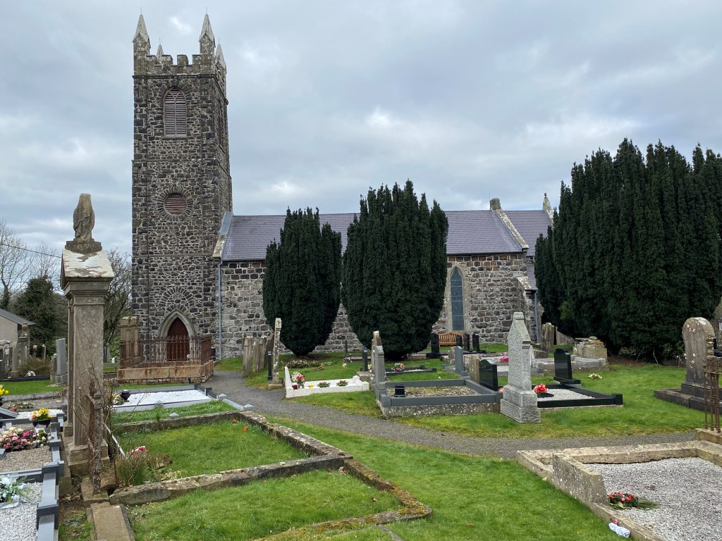
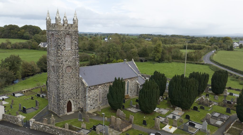
20. St Guaire’s Parish Church, Aghadowey

19. Slaghtaverty
7th March 2023
Shared Music of Dalriada – Flowerfield 2023
24th March 202320. St Guaire’s Parish Church, Aghadowey

Set on a site of great antiquity, the current church dates from 1797. St Guaire, thought to be a corruption of Jerome, is said to have founded a monastery here in the 7th century. It was noted in 1622, that the church was in ruins and was to be repaired. The church was rebuilt in 1797 with a tower and spire.
There are two bells in the tower, the older bell is dated 1695 and was presented by Queen Anne to her chaplain, Reverend Robert Gage. The descendants of Reverend Gage presented the bell to the church.
St Guaire’s Church
Saint Guaire founded a church in Aghadowey in the 7th century, thought to be a cell of the Abbey erected by him at Agivey.
About 1609, St Guaire’s Church was referred to as “the Church of St Jerome” in Bishop George Montgomery’s survey. At the Plantation of Ulster, most of the land around Aghadowey was allocated to the Ironmongers’ Company. In 1622 it was noted that the church at Aghadowey was in ruins but was to be restored “by my Lord Primate’s appointment is to be repaired out of the recusants’ fines.”[1] [Recusants’ fines were fines levied on those who refused to attend Church of Ireland services]. The same year the Parish of Aghadowey became one of the three Prebends of St Columb’s Cathedral in Londonderry[2] (this meant that the rectors from 1622 until 1873 were Canons of the Cathedral).
St Guaire’s Church.
The church was repaired about 1760 and rebuilt in 1797. The church was rebuilt with ‘handsome tower’ with an octagonal spire erected at the expense of the Earl Bishop of Derry. The spire was destroyed by lightning in 1828 and the surviving tower structure was subsequently embattled and crowned with pinnacles.[3] A large part of the spire was demolished in the lightning strike and the bell knocked down, “tearing a hole in the north wall of the church and flinging twent-pound stones on to a nearby bleach green. Andrew Orr’s pew was torn six feet away from the wall, the other pews were shattered and the lightning finally exited through the east window which it smashed into pieces.”[4]
The church is shown on the 1832 OS map as simple hall with tower. The belfry was repaired in 1833 and a road added to the graveyard in 1861. The church was enlarged in 1879 with the addition of a chancel, robing room and gallery and a new door and window were fitted in the tower.
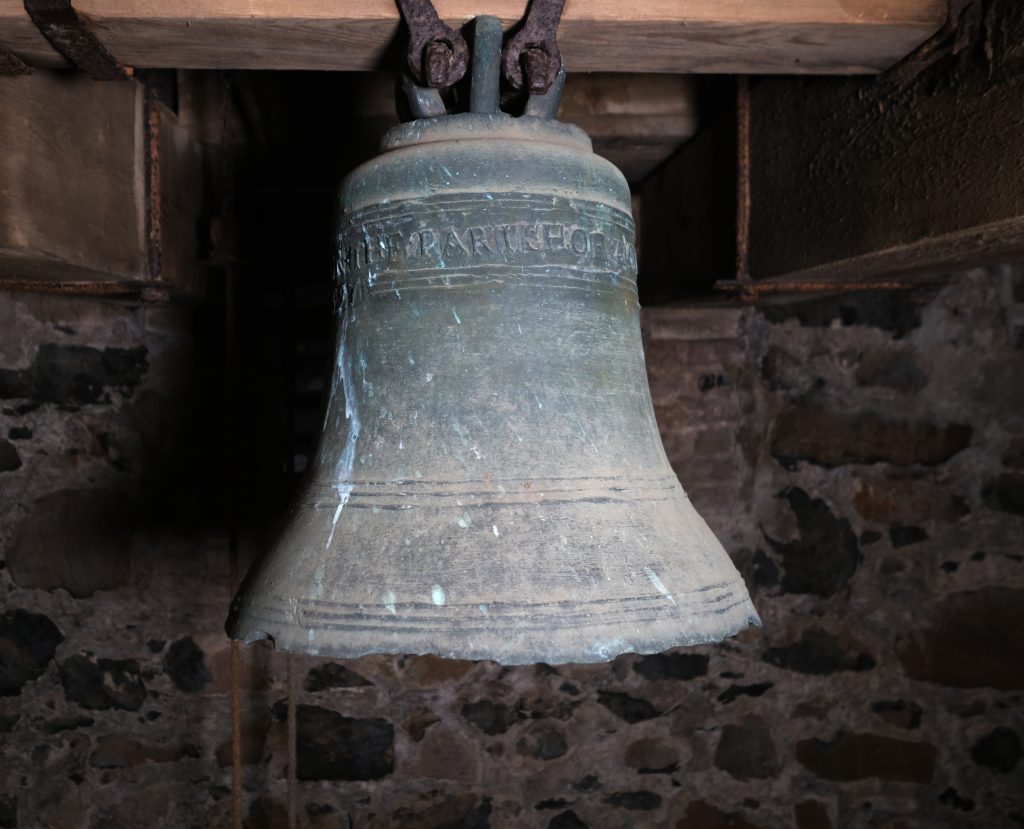
The small bell, dated 1695, in the tower of St Guaire’s Church.
There are two bells in the tower. The older bell, dated 1695, was presented by Queen Anne to her chaplain, Rev. Robert Gage, who was Prebend of Aghadowey from 1691 to 1725. The Gage family acquired the Magilligan estates in the 17th century, purchasing the lease from the Lord Bishop of Derry. William Gage, Robert’s father, was Mayor of Londonderry 1631 – 1632. Robert’s son John, born in 1693, succeeded him as Prebend of Aghadowey in 1725 and held the office until his death in 1763. Rev. John Gage bought Rathlin Island from the Earl of Antrim in 1746.
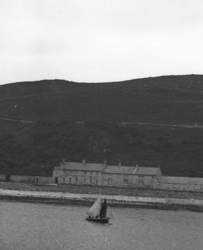
The Manor House, Rathlin Island. Rev. Robert Gage’s grandson, Robert, built the Manor House in the late 1700s. Courtesy of the Sam Henry Collection.
[1] St Guaire’s Church Parish of Aghadowey. R. J. Wilson.
[2] The Church of Ireland: An Illustrated History. Ed. Dr Claude Costecalde & Prof Brian Walker
[3] OS Memoirs
[4] Aghadowey. T. H. Mullin
Directions
Co-ordinates: 55.0291, -6.6576
This project is receiving financial support via the District Council Good Relations Programme.