14. King’s Fort

13. King of Ballycastle
7th March 2023
15. Lurigethan
7th March 202314. King’s Fort
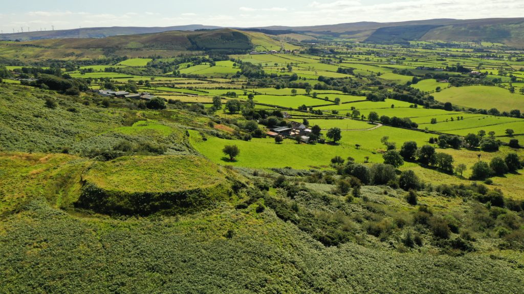
King’s Fort, at the foot of Donald’s Hill, near Drumsurn, commands a strong defensive position with magnificent views up the Kilhoyle Valley towards Dungiven, south to the Sperrin Mountains and across the Foyle Valley to the west.
King’s Fort, its old name was Dun Conchubaire, is an early medieval (c. AD 400-1100) royal site steeped in local legend. One story tells of the demise of the witch Meabh; another, that Brian Boru ousted the Danes from the fort. It is one of the best preserved ringforts in Ulster and the OS Memoirs described it as “a Danish fort of wonderful strength and large dimensions…”
Directions
Please Note: The site is located on private property, however, the Ulster Way passes nearby and is sign posted from Kilhoyle Road.
Co-ordinates: 54.9897, -6.8449 (nearest public vehicular access)
This project is receiving financial support via the District Council Good Relations Programme.