
Print of a map (black and white colour). Note at top left reads, ‘Map of a large portion of the original town of Nutfield settled in 1719 and chartere… – scan212d
Print of a map (black and white colour). Note at top left reads, ‘Map of a large portion of the original town of Nutfield settled in 1719 and chartere… – scan212d
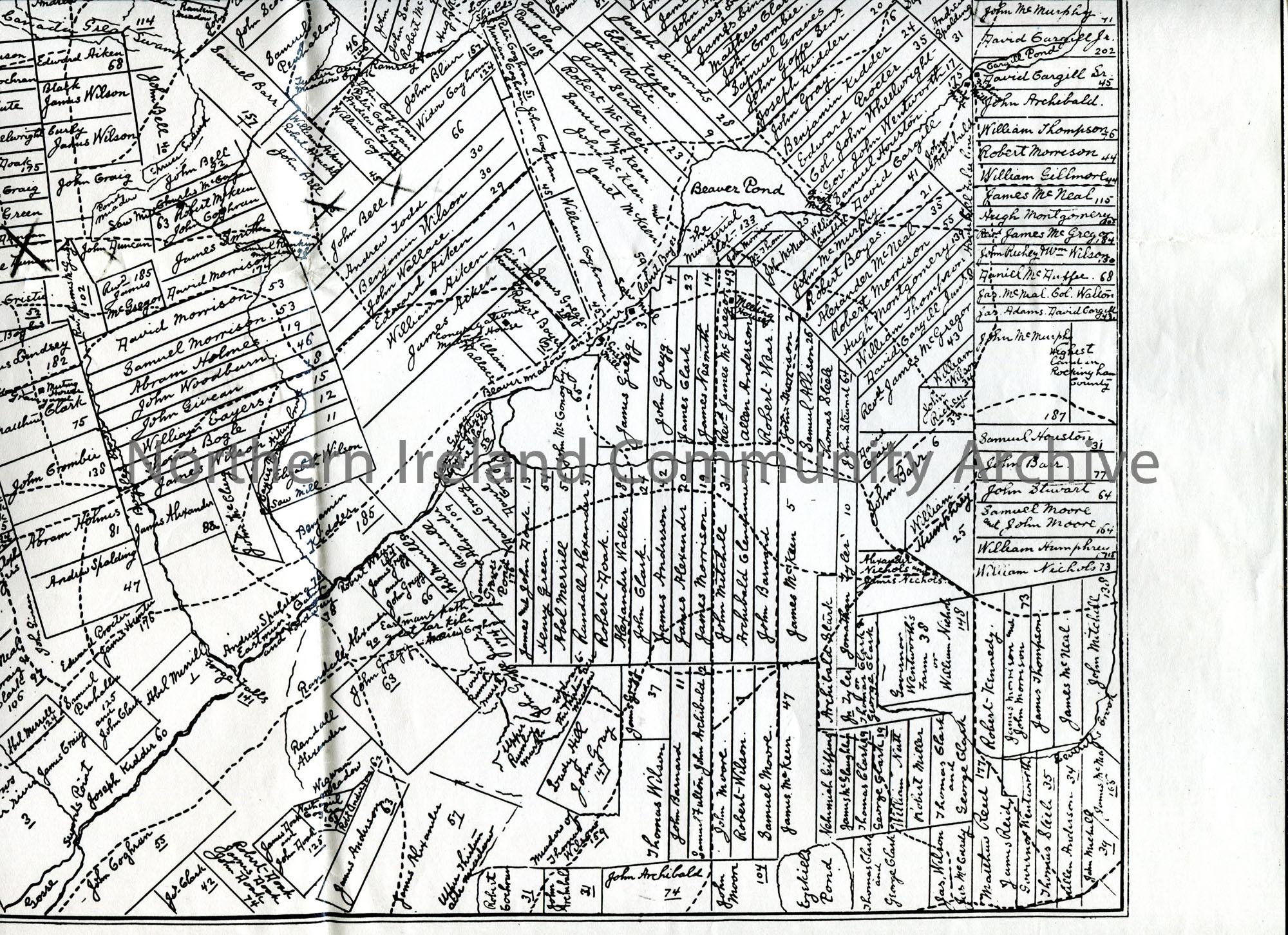
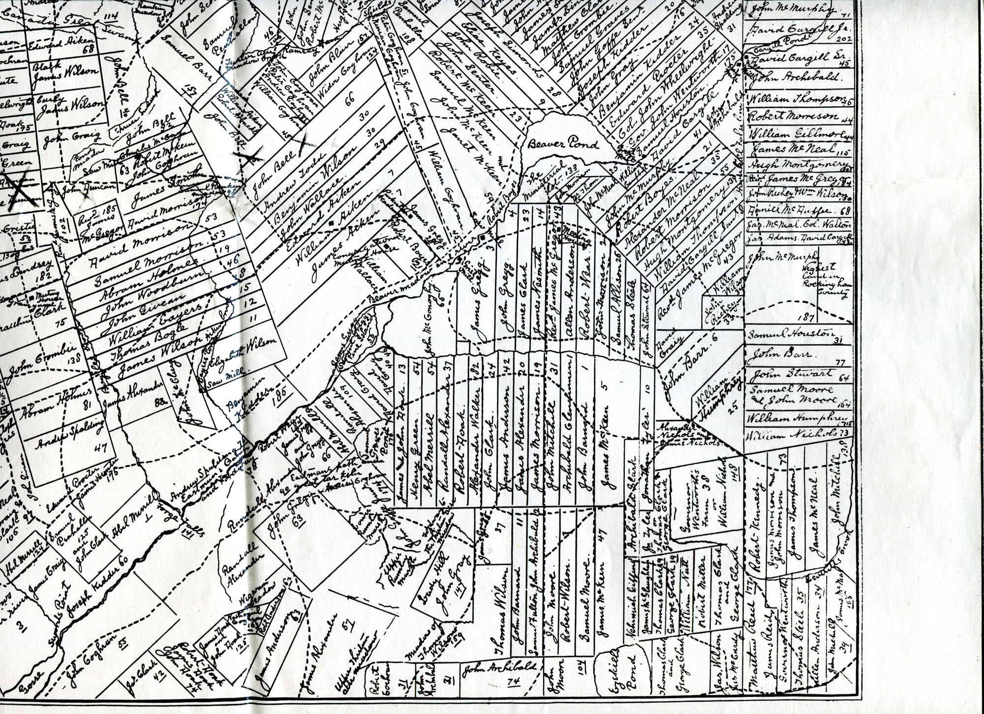
Print of a map (black and white colour). Note at top left reads, 'Map of a large portion of the original town of Nutfield settled in 1719 and chartered as Londonderry in 1722, prepared and drawn by Revd J. G. McMurphy. All rights reserved'. Contains the names of those living on the land. 'X' marked on map at names John Bell and John and George Duncan.
Place
Archive Attributes
Collection:
Owner:
File Type:
Accession Number:
CM:2017:3071
Added to archive:
04-07-2019