Home
What’s On
Explore the Archive
Project Posts
Learning & Resources
Heritage Trails
Accessibility
Contact Us
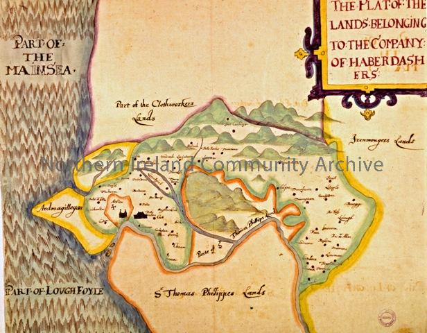
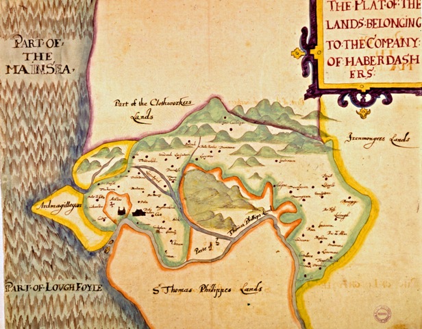
Map showing Haberdashers Company lands
Ceramics created through Images of Ireland (5318)
Macosquin Well as titled by Sam Henry
Map showing Haberdashers Company lands
View Document
Thomas Raven map of Haberdashers Company lands, 1622.
Place
Archive Attributes
Collection:
1613 - 2013: Project of Plantation
Owner:
Coleraine Museum
File Type:
Image
Object date:
1622
Added to archive:
23-03-2018
Share
